RICHMOND, Va.–(BUSINESS WIRE)–VertiGIS, a worldwide leader in spatial asset management solutions and geographic information system (GIS) software is proud to announce the latest addition to the new VertiGIS Networks product line: VertiGIS Network Locator. This innovative locates solution for underground utilities revolutionizes the way companies handle the demand of 811, Call-Before-You-Dig and One-Call responses with […]
Ecobot Launches StoryMap Demonstrating Regional Effects of SCOTUS Ruling

ASHEVILLE, NC / ACCESSWIRE / June 15, 2023 / Ecobot, the platform driving the digitization of mandatory pre-construction environmental assessments, today launched an interactive ArcGIS StoryMap to help environmental consultants and citizens understand how the recent Sackett v. EPA ruling by the Supreme Court of the United States (SCOTUS) will play out across the country based on existing local, state, […]
TCarta to Deliver Satellite Derived Bathymetry for 13 Regions to National Geospatial-Intelligence Agency
Work will be completed under contract to Maxar
Free eGuide – Python for IT Professionals

If you’re an IT executive or an IT pro, you might be wondering how Python can help you in your day-to-day job.
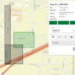
Local authorities use Esri GIS to modernise planning

Esri UK today announced the results of three pilot projects at Nottingham City Council, Dacorum Borough Council and South Ayrshire Council, which have been exploring new ways of digitising the planning process using geospatial technology. Projects have focused on solving common challenges within planning, including the improvement of community engagement, maximising the use of 3D […]
Microsoft Windows 11 Reference Card

This Microsoft Windows 11 Reference card provides shortcuts, tips, and tricks for the popular operating system.
HERE works with AWS to provide indoor/outdoor device positioning services to AWS third-party developers

CES 2023, Las Vegas – HERE Technologies, the world’s leading location data and technology platforms, today announced its work with Amazon Web Services (AWS) to deliver developers with improved performance for indoor/outdoor positioning capabilities to track and manage any number of internet-of-things (IoT) devices.
Multi-Display Signage for the Federal Sector

Matrox and BrightSign are ready for deployment
Teledyne announces new Ladybug6 cameras for high accuracy 360-degree spherical image capture

Richmond, CANADA ─ October 17, 2022 ─ Teledyne FLIR Integrated Imaging Solutions is pleased to announce the all new Ladybug6— the latest addition to its field proven Ladybug series. Ladybug6 is the leading high-resolution camera designed to capture 360-degree spherical images from moving platforms in all-weather conditions. Its industrial grade design and out-of-the-box factory calibration produces 72 […]
Mosaic Announces Integration of High Resolution 360º Camera with Laser Scanning Solutions

October 10, 2022 – Ready for release – Mosaic X high resolution cameras, enabling customers to gather more valuable data with their mobile mapping solutions, now compatible with RIEGL’s line of Mobile Laser Scanning Systems.